Greenland is often viewed as a massive piece of land covered in ice.
Beneath that frozen surface lies a completely different world that most people never picture.
Yet getting a clear view of that hidden landscape has always been nearly impossible.
For decades, scientists could only guess at what was hidden beneath the freezing expanse.
New mapping methods from NASA have finally brought this world into focus.
This creates a complex network similar to a buried road system.
Inferring the hidden terrain beneath the ice
The ice sheet is huge, covering around 1.7 million km2 and stretching over 3km thick in places, concealing every piece of land underneath.
You cannot explore the terrain on foot, take aerial photographs, or view it from orbit. Instead, you must piece together what the hidden landscape looks like.
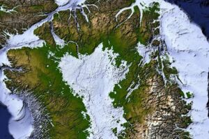
As the ice moves over underlying hills and valleys, small bumps can be seen on the surface.
These faint signatures can be identified and measured.
This allows us to piece together a clear picture of what the buried terrain looks like.
A complex network carved underneath the sheet
The hidden landscape under Greenland turned out to be much more complex.
Some of those features are far longer than expected, extending hundreds of kilometers further than previously thought.
Rather than isolated depressions, they link multiple valleys together into extensive networks. This suggests that the landscape dates back a long time.
Surprising structural alignment across the entire region
The organization of the valleys suggests they were not random.
Across some areas of Greenland, multiple valleys run in remarkably similar directions, following a south-west to north-east course across large regions.
If the valleys were purely due to localized factors, they would be expected to branch off and meander in random directions.
There appears to be a clear structure to their layout. This organization suggests other forces were at play.
Beneath the eastern section of the ice sheet, this structural layout includes a hidden mountain range where valleys grow deeper toward the coast, as detailed in Geophysical Research Letters.
Ancient channels shaped by flowing subglacial water
Zooming into those connections, the valleys branch off to form a system of channels where individual junctions meet at quite wide angles.
This suggests that the landscape was influenced by surface water.
Additionally, some valleys may even have been formed by groundwater before the ice sheet expanded across Greenland.
Viewed together, the valleys have formed an identifiable landscape that may date back much longer than the ice sheet above.
How these hidden valleys guide massive glaciers
Those ancient valleys are still influencing Greenland today. Ice naturally flows down slopes.
Once it reaches existing valleys, ice flow becomes concentrated along those pathways and strengthens over time.
Some of Greenland’s largest glaciers already follow these hidden routes beneath the ice.
The valleys continue influencing the movement of ice across large areas of the island.
As those heavy layers push through these channels, the thicker portions travel faster.
This continues to deepen the landscape as the immense weight of the ice continues to carve and deepen the terrain below.
Directing Greenland’s changing landscape into the future
This means the hidden landscape is not just a remnant of Greenland’s history but may also influence its future.
As sections of the ice sheet recede, ice is expected to continue flowing through many of the same carved channels that already guide where ice moves.
Underneath the massive ice sheet of Greenland, this hidden terrain is still directing the ice, connecting the island’s ancient history directly to the changes happening today.
Read the whole thing?
Get the week's signal, not the noise
Our sharpest reporting on energy, climate and nature — free, once a week.