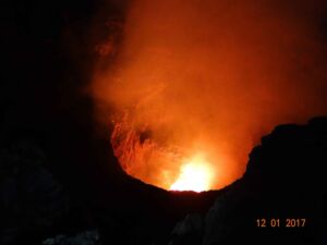
Masaya volcano, in Nicaragua, draws tourists from around the world to watch molten rock glow from its Santiago crater — a rare, accessible window into Earth’s interior. But beneath that spectacle, something quieter and stranger has been unfolding. Scientists tracking the volcano with satellites noticed that the ground wasn’t moving as a single unit: one section was sinking while another was rising, at the same time, for reasons that didn’t fit the accepted picture of what lies below.
The volcano sits roughly 13 miles from nearly 2 million people. Researchers are only now beginning to piece together what those conflicting movements reveal.
A volcano hiding more than one secret
Masaya isn’t just any volcano. It hosts one of the world’s few persistent lava lakes, sits inside a national park, and draws visitors who peer directly into the Santiago crater. About 2 million people live within 13 miles of the caldera, including residents of Managua, Nicaragua’s capital. Even without a dramatic eruption, the volcano continuously releases sulfur dioxide — a gas that can reach dangerously high concentrations for visitors and nearby communities alike.
The last major lava flow happened in 1772, but the hazard never fully disappeared. Despite years of study, scientists had an incomplete picture of what drives Masaya’s activity. A closer look from orbit changed that.
How satellites read a volcano’s pulse
The research team used the Sentinel-1 satellite, which passes over Masaya roughly every 12 days. Over six years, those repeated passes built a detailed record of how the ground was shifting. The technique is called interferometric synthetic aperture radar, or InSAR — it works by comparing radar signals bounced off Earth’s surface at different times.
When the distance between satellite and ground changes, even by millimeters, those shifts appear in the data. Radar microwaves cut straight through cloud cover, which makes this approach especially useful in tropical regions like Nicaragua. Stacking years of observations also filters out short-term noise, revealing slow, deep processes invisible in any single image.
Two reservoirs, two stories
Between 2018 and 2024, the data revealed something that resisted easy explanation. The broader caldera floor first subsided gradually, then reversed and began to rise — a pattern scientists interpret as consistent with magma draining from a deep reservoir and then refilling as fresh magma moved in.
The ground immediately around the Santiago crater told a different story entirely. It kept sinking throughout the entire six-year period, never joining the caldera’s eventual rebound. That divergence is the critical clue. Two sections of the same volcano moving in opposite directions simultaneously suggest two distinct magma reservoirs operating independently of each other.
“This indicates that the plumbing system is more complex,” lead author Lizzie Johnson noted in the study, pointing to the independent behavior as evidence of separate underground structures.
What this means for eruption forecasting
The findings don’t signal any immediate danger to communities near Masaya. They do, however, matter enormously for how scientists interpret the volcano going forward. Before this study, monitoring data was read against an assumed baseline — one underground system behaving as a unit. That picture now needs updating.
Signals that once seemed straightforward could actually reflect two reservoirs pulling in different directions at once, and knowing that distinction exists means future anomalies can be caught earlier and read more accurately. Continuous satellite monitoring combined with improved models could help researchers detect warning signs with greater confidence.
The implications may reach well beyond Nicaragua: other volcanoes worldwide that host persistent lava lakes could share similar hidden architectures, making Masaya a potential template for rethinking how those systems are monitored.
From an undergraduate thesis to a new chapter in volcano science
The research began as Lizzie Johnson’s senior honors thesis at Penn State’s Schreyer Honors College — her first experience with scientific research of any kind. She joined professor Christelle Wauthier’s group after attending a campus presentation, then learned satellite data analysis and scientific coding alongside doctoral researcher Young Cheol Kim.
Published in Geophysical Research Letters and supported by the U.S. National Science Foundation, the study has since launched Johnson into a PhD program at the University of Hawaii at Manoa, where she’ll use seismic imaging to study Kilauea. The skills she built at Masaya — reading ground deformation, working with years of satellite data — will travel with her, along with the questions she helped raise about hidden magma reservoirs.
Read the whole thing?
Get the week's signal, not the noise
Our sharpest reporting on energy, climate and nature — free, once a week.