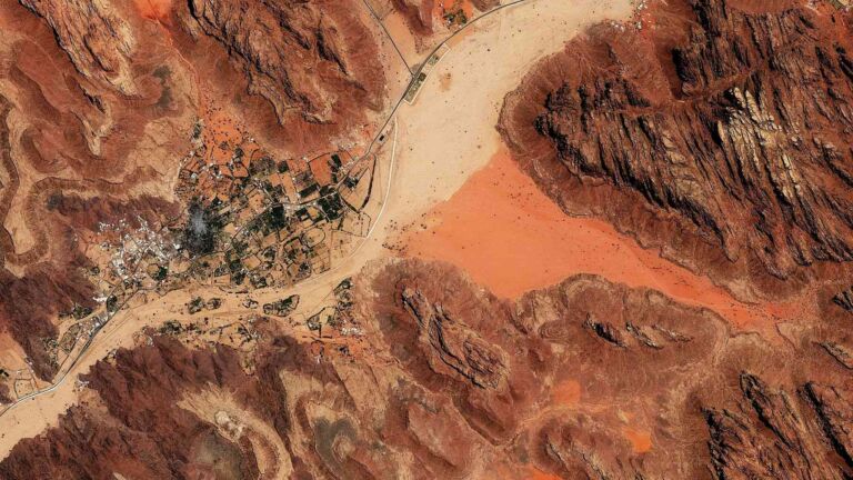
From orbit, it looks like a ribbon of shadow cut through a wildfire of red and gold. On October 25, NASA’s Landsat 8 satellite captured Pennsylvania’s Pine Creek Gorge at peak autumn color — a 45-mile canyon cutting 1,500 feet deep through the Allegheny Plateau, its forested slopes burning with the season.
The gorge looks ancient and undisturbed from that altitude. It is ancient. But undisturbed? That’s another story — one that starts with glaciers routing a river backward and ends somewhere far darker than a satellite image suggests.
A canyon carved by ice and a river that ran the wrong way
Pine Creek Gorge didn’t form the way most people assume. Ice didn’t chisel it directly. Instead, glaciers advancing from the northeast during the last ice age dammed Pine Creek — which originally flowed northward — and flooded the valley into a chain of lakes. When those lakes overflowed, water found a new path south, and by the time the ice receded, the river was already locked into its reversed course.
What followed was a long process of deepening. Rocks and sand left by the melting glaciers blocked any return to the old northern route, and meltwater kept rushing through, cutting steadily downward until the gorge reached its dramatic form: 45 miles long, nearly 1,500 feet deep, winding through the Allegheny Plateau.
Lush slopes, vivid seasons — and a landscape nothing like the Arizona original
The comparison to Arizona’s Grand Canyon is flattering, but it only goes so far. Where the Southwest offers bare sandstone walls in shades of rust and ochre, Pine Creek Gorge is blanketed in living color — northern hardwood, mixed oak, hemlock, and white pine covering nearly every slope. The rock itself is largely hidden beneath all of it.
That distinction becomes most vivid in autumn. Deciduous trees ignite in reds and golds that, according to NASA, produce hues “akin to the rock of the famous Arizona canyon.” A different kind of spectacle entirely — organic rather than geological, temporary rather than permanent.
NASA’s Landsat 8 satellite, carrying the Operational Land Imager instrument, captured exactly that moment on October 25, 2026. The image shows the gorge at peak fall color, running from Ansonia in the north to its confluence with the West Branch Susquehanna River, deepest near Waterville. It’s also a reminder that satellites do more than map terrain — they track living systems through time, season by season.
From stately forests to ‘Pennsylvania Desert’: the logging era that stripped it all
The gorge that Landsat 8 photographed in full autumn glory once looked nothing like this. In the early 19th century, surging demand for wood products drew commercial loggers into a forest of genuinely impressive scale — white pines and hemlocks several feet in diameter, alongside towering hardwoods. Each tree had a specific market value.
White pine was prized for ship masts. Hemlock bark fed the leather tanning industry. Both were harvested aggressively, and the gorge’s geography actually made extraction easier: before railroads arrived, loggers simply floated their timber down Pine Creek to the Susquehanna River in massive log drives. The efficiency was the problem.
Decade after decade of clear-cutting left the slopes nearly bare. By the early 20th century, the damage was visible enough that locals gave the area a blunt nickname: the “Pennsylvania Desert.” Not hyperbole — a description.
A forest reclaimed: wildlife, protection, and a landscape reborn
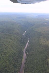
Recovery wasn’t guaranteed. Heavily logged land can stay degraded for generations, especially on steep terrain prone to erosion. Pine Creek Gorge came back anyway — slowly, measurably, and fully enough that today it supports black bears, coyotes, bobcats, timber rattlesnakes, and a wide variety of songbirds.
In 1968, 30,000 acres of the gorge area were formally designated a National Natural Landmark, an acknowledgment that the ecosystem had earned genuine protection. Visitors can now experience it through multiple state parks and the Pine Creek Rail Trail, which follows the old railroad corridor that once carried logged timber out of the valley. The transformation is striking in its completeness — the same route that enabled industrial-scale deforestation now guides hikers and cyclists through a thriving forest.
What the Landsat 8 image doesn’t show is time — a century of regrowth compressed into a single October afternoon. But that’s worth sitting with. A landscape stripped so thoroughly it earned the name “Pennsylvania Desert” is now visible from orbit as a blaze of autumn color. It raises a reasonable question: how many other places, written off as lost, are quietly doing the same thing — and what would it take to let them?
Read the whole thing?
Get the week's signal, not the noise
Our sharpest reporting on energy, climate and nature — free, once a week.