

There was a large structure that no longer exists. All we have left are the scours.
These look very strange and show that the landscape was very different, while also indicating that multiple ice sheets interacted as one.
There is no physical evidence of the structure itself, leaving only the scours behind to question what it once was.
Understanding how something so colossal vanished without a trace requires comparison with modern polar analogs.
They all relied on the same floating support system
Ice shelves provide support for the grounded ice. That support helps slow down the movement of the ice and keeps things stable.
However, the ice shelf in Baffin Bay was connecting Greenland, Innuitian, and Laurentide, showing that they were part of the same system.
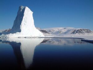
Any changes to this support would not be local because there was a mechanical link between the sectors.
The support at the margin was important as the grounded ice could respond to the lack of support, making this a key part of the reconstruction.
Ancient basin dimensions revealed something much larger
This ice shelf covered approximately 58,000 square miles, spanning from Greenland to the edges of nearby ice sheets in Canada.
As a result, the basin became an interconnected glacial environment where the ice provided the connection.
The ice shelf spanned horizontally very widely, comparable to some of the largest ice shelves in Antarctica.
Such a scale immediately changes expectations of the ancient Arctic, showing the basin was an important part of a much larger system.
Hidden clues still rest beneath the seabed
Using sonar, we found landforms that had contact with the ice that were over 1.6 km below sea level, as described by the University of North Carolina Wilmington.
Previous examples from the Northern Hemisphere suggest that these ice shelves were extremely thin. It is a striking mismatch that forces a rethink of previous depth models entirely.
Evidence points to a much larger structure than previously reconstructed, showing that the ice shelf must have been much thicker than expected.
Sediment cores taken from throughout the basin indicate that the ice was retreating slowly over approximately 500 to 1,000 years, supported by multiple pieces of evidence and findings published in Nature Geoscience.
Not every piece of the original story survived
Much of the important parts of the original information have been lost over time, leaving us with only fragments.
The seabed is constantly changing due to currents, erosion, and deposition, meaning older information can be changed, hidden, or even completely removed.
Each sediment core will only give information from a small area, resulting in large gaps between data collection. Because we cannot fully reconstruct the ice layout, some information has already been lost.
Retreat was only one part of the bigger story
The rate of retreat affected how the surrounding glacier systems responded, though not all the connected sectors would have responded the same way.
As the ice lost its support, the grounded ice was free to move outwards, increasing the rate of loss of land-based ice.
Not all responses would have been instant, and changes could have occurred unevenly in the interconnected systems.
Understanding that timing is important when considering large marine-based glaciers, as small differences can cause big changes.
One major uncertainty remains unresolved today
The largest unknown is sensitivity, as we do not have any direct evidence to show how sensitive each neighboring ice sheet was.
The geological evidence does show that they were interconnected, though how sensitive they were is less clear.
That uncertainty affects attempts to understand how interconnected glacier systems would respond, since it depends on how the responses traveled through the network.
For now, the best evidence we have is the ancient scours below Baffin Bay.
Read the whole thing?
Get the week's signal, not the noise
Our sharpest reporting on energy, climate and nature — free, once a week.


