There are scientists working with the geosciences who have obtained real evidence of two underwater landslides in Lake Iseo, Italy, which resulted in massive lake tsunamis.
It is known through historical records that there were landslides in 1117 and 1222, as there was an enormous amount of sediments mobilized on the steep river delta slopes.
Computer modeling shows that the waves formed were extremely powerful and, indeed, in one case it could make the lake water rise.
Core samples of basin sediments for studying lake tsunamis
The researchers cored deep basin deposits in the subaqueous lake bottom to investigate sedimentary layers accumulated for centuries.
The stratigraphic profile revealed abnormal coarse-grained debris lobes deposited compactly in between fine organic muds.
The grain analysis showed that these thick deposits were a consequence of sudden underwater slope failure and not riverine runoffs, which caused debris flows.
These sediments were then radiocarbon-dated to a catastrophic earthquake event that took place during the Medieval age.
The records in history mention that there was a major earthquake event that took place in northern Italy in January 1117 and December 1222.
The underground core samples provided an uninterrupted history of prehistoric and historic aquatic disturbances.
Geologists estimated the quantity of displaced material.
Ancient agricultural clearing and delta slope destabilization
Deforestation, cultivation, and other similar acts on the Alpine slopes around it resulted in soil erosion at an extremely high rate.
The mountain rivulets washed down large quantities of soil and gravel into the developing delta plain of the Oglio River.
The deposit of sediment was too much for the undersea delta front to be stable and overly burdened.
The overloaded slopes failed during tremors, which triggered underwater landslides along the steep lake bed.
The human actions set up conditions for the subaqueous delta to fail catastrophically.
Farming activities altered sediment transport into the deltaic system.
Too much silt deposition occurred before the natural compaction process could take place.
Simulating underwater landslide dynamics and massive waves
Models of mathematical equations and hydrodynamics of the movement of sediment mass were developed.
Gravity had the effect of pulling millions of cubic feet of sediment to the bottom of the slope in the subaqueous environment in the medieval era.
There were instantaneous displacements of huge amounts of water that caused massive waves all over the glacial valley at up to 122 miles per hour.
The heights of the simulated wave runs were similar to the physical evidence present in the historical records.
Modern tsunamis in Alpine lakes
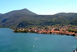
The lowlands, which have been settled by inhabitants and are active tourist sites, surround the picturesque shorelines of Lake Iseo.
Computer models have estimated that the waves resulting from the tsunami would take minutes to reach the nearby coastal areas.
In minutes, the Iseo water levels will rise sharply by 18 feet.
Evacuation planning is made harder considering that the landslide tsunamis come with no warning time whatsoever.
The underwater steeper slope will make subsequent earthquakes destabilize the unstable delta front in the future.
No protective structures are present in the municipalities to shield the coastline from the abrupt influx of the water inland.
Infrastructure at risk due to future tsunami displacement
Analysis of hazard mitigation for tourism centers in the long run
It is becoming increasingly important for local authorities to integrate the underwater landslide process into emergency plans in Lombardy.
Sediments deposits in the Oglio River delta are recorded through bathymetric surveys in order to identify the thresholds, according to Nature Communications.
The early warning system cannot detect silent landslides that take place below water off the coast.
Engineering structures are not enough to protect populated lakeside promenades and docks.
While tourism and geologic safety in the Alps need to be considered, an active hazard assessment needs to be done.
Monitoring of seismic activities should go hand-in-hand with subaqueous slope monitoring.
Preparedness will determine whether the future is devoid of medieval disasters.
Read the whole thing?
Get the week's signal, not the noise
Our sharpest reporting on energy, climate and nature — free, once a week.