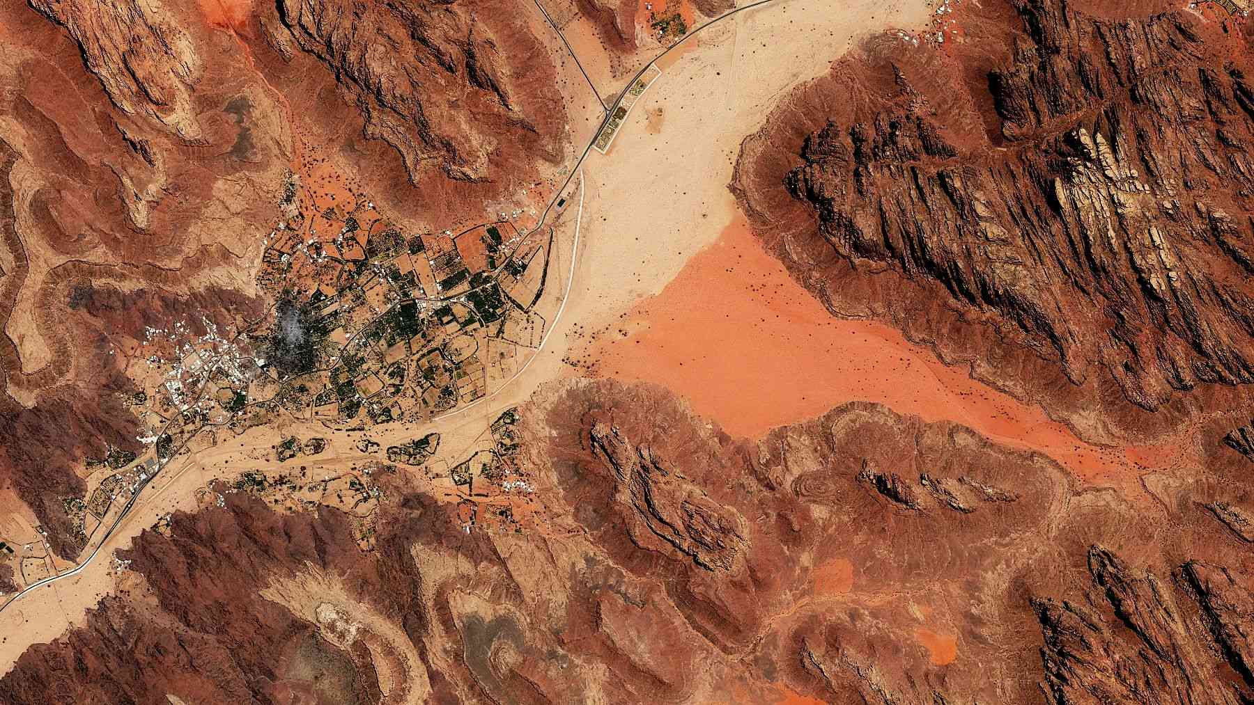
On a narrow ridge in northwest Morocco, where the Oued Beht river cuts through a landscape of hills and ravines, archaeologists have uncovered something that wasn’t supposed to exist here: massive fortifications, built from stone and earth, stretching back roughly 4,000 years.
The scale of the construction caught researchers off guard. So did its age. Dating to around 2000–1500 BC, the defensive system is now confirmed as the earliest large-scale architecture of its kind ever found in North Africa outside Egypt — and what it says about the people who built it may force a significant rethink of the ancient Maghreb.
A site that keeps rewriting itself
Oued Beht was already extraordinary before the wall turned up. Earlier excavations had uncovered what is likely the earliest and largest agricultural complex ever found in Africa outside the Nile Valley, dating to roughly 5,400–4,900 years ago. Then the 2023 season pushed the story further, revealing a large-scale defensive structure between 4,000 and 3,500 years old — the earliest confirmed of its kind in North Africa beyond Egypt.
The site spans at least ten hectares and shows multiple phases of human activity, from the Final Neolithic through the medieval period. Thousands of polished stone axes, finely decorated pottery, and clear evidence of barley and wheat cultivation all point to a sophisticated, well-organized prehistoric community — a far cry from the fragmentary, poorly understood picture researchers had long accepted for this region.
What the wall actually looks like — and what it took to build
The structure isn’t a single wall. It’s a multi-phase system: a ditch, a rampart, and a wall cutting across a narrow section of the Oued Beht ridge, sealing off and protecting its southern tip between the river and a ravine, according to the article published in The Conversation.
The earthworks hadn’t gone entirely unnoticed. French archaeologist Armand Ruhlmann documented the formation back in the 1930s, describing what he called a barred spur — three walls with the fourth side protected by the ridge’s natural scarp. Their age and true nature, though, stayed uncertain for nearly a century. Radiocarbon dating of deposits associated with the structures finally settled the question: construction dates to a period equivalent to the Bronze Age of the western Mediterranean, roughly 2000–1500 BC. Erecting an embankment-and-ditch system at that scale required coordinated planning and organized labor — not traits of a loosely structured community.
Why communities felt the need to defend themselves
What exactly prompted the construction remains unclear. Researchers don’t point to a single invading force. The wall is linked instead to growing competition over land, resources, and control of movement through the landscape — a more complex picture than any straightforward invasion narrative.
There’s a spatial clue embedded in the site itself. During the earlier Neolithic phase, activity at Oued Beht centered on the larger, more open northern area. By the time the wall was built, the focus had shifted to the narrower, more defensible southern ridge — suggesting communities were actively rethinking how they managed and protected their territory. Structures like this also reveal something about social organization. Building them requires leadership with the authority to plan, direct, and sustain large collective efforts, pointing to increasingly formalized hierarchies emerging in the region and mirroring broader transformations happening across the Mediterranean world during the second millennium BC.
Connected to a wider Mediterranean world
That parallel with the Mediterranean isn’t coincidental. During the same period, Argaric societies in southern Iberia — active roughly between 2200 and 1550 BC — were constructing fortified hilltop settlements, developing advanced bronze metallurgy, and displaying marked social hierarchies in their burial practices.
Growing evidence suggests northwest African communities weren’t watching from the sidelines. They were actively participating in Mediterranean-wide networks, with connections reaching into what is now Spain and Portugal. The Oued Beht wall may reflect the same regional pressures — resource competition, expanding trade, more formalized governance — that were reshaping societies across the sea. The Maghreb, in other words, wasn’t an isolated backwater. It was part of the story.
A landscape chosen again and again across millennia
Centuries after the prehistoric settlement was abandoned, the same ridge drew people back. During the 11th to 13th centuries AD, the defensive structure was rebuilt, a hamlet or farm appeared on a nearby hilltop, and a cemetery was laid out between the two areas.
That repeated return across thousands of years says something important. Oued Beht wasn’t a single-period settlement that happened to leave traces — it was a place of enduring strategic and cultural value, recognized as such by communities separated by millennia. As research continues, the site may become a key reference point for understanding how societies in the Maghreb evolved from early farming communities to the medieval rural world. The wall was just the beginning.
Read the whole thing?
Get the week's signal, not the noise
Our sharpest reporting on energy, climate and nature — free, once a week.