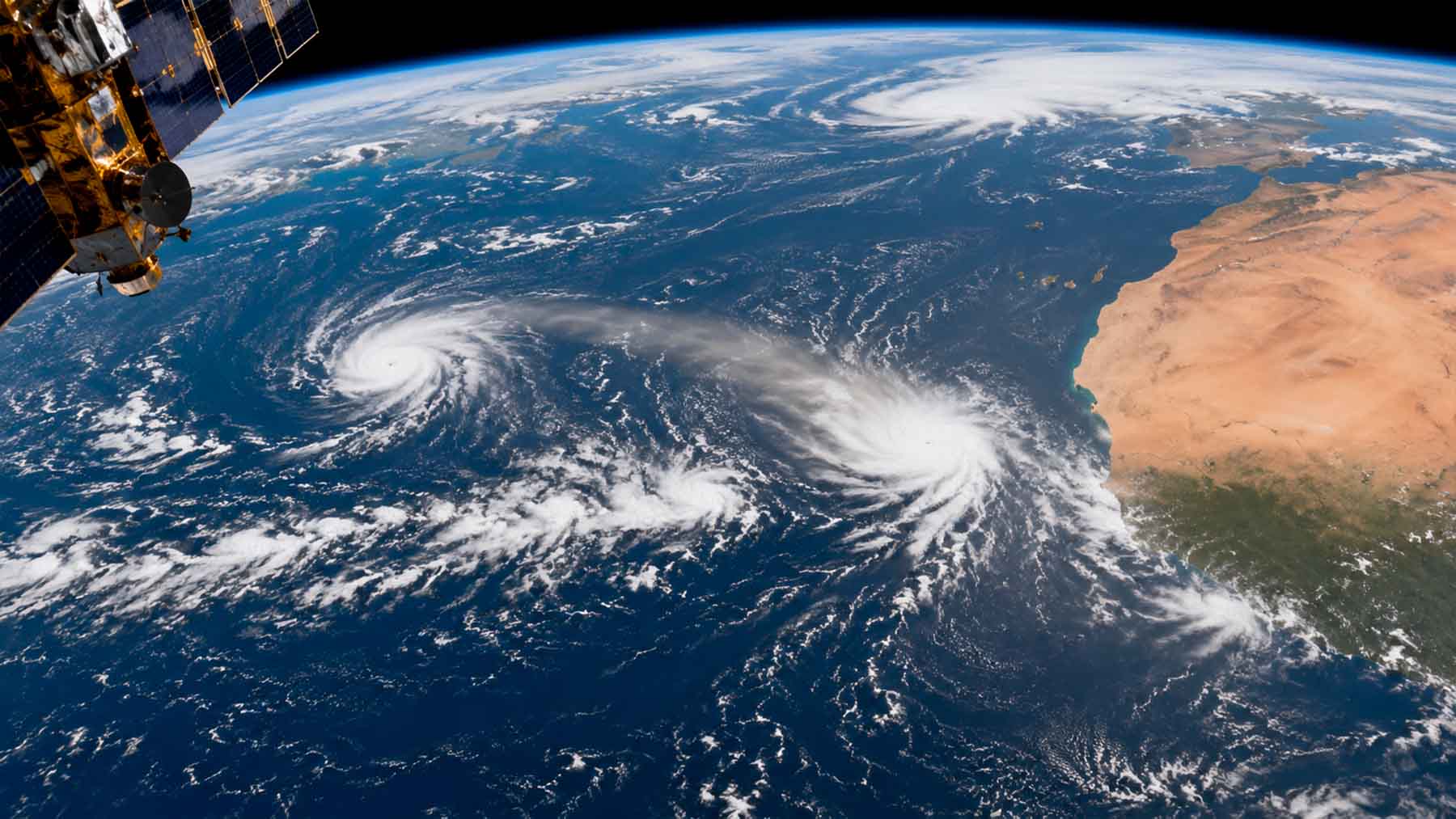
Two hurricanes are churning through the Pacific right now — but they didn’t start there. Fausto and Genevieve were born thousands of miles away, off the sun-scorched western coast of Africa near Cape Verde, as clusters of disturbed weather peeling off a hot, dry continent.
From there, each storm made an improbable journey: westward across the Atlantic, over the mountains and jungles of Central America, and into the Pacific — where something was waiting for them.
Born in Africa, destined for the Pacific
Tropical waves are exactly what they sound like: rippling disturbances in the atmosphere, born where scorching Saharan air meets cooler ocean winds near Cape Verde. Both Fausto and Genevieve started as modest clusters of thunderstorms and clouds, peeling off the African continent and drifting westward on the prevailing trade winds.
Their journeys were anything but guaranteed. Each wave had to survive the full width of the Atlantic, negotiate the terrain of Central America, and emerge intact on the other side — where the Pacific was ready to finish the job.
Once they arrived, warm ocean waters and favorable atmospheric conditions did exactly what forecasters feared. The waves intensified rapidly into full hurricanes. Jason Dunion, a hurricane scientist at NOAA‘s Atlantic Oceanographic and Meteorological Laboratory, notes that most Atlantic hurricanes also trace their roots to Africa — but the Pacific connection remains far less widely understood.
How NOAA satellites followed every mile
Tracking a storm across two oceans and a continent requires more than one set of eyes. NOAA operates two geostationary satellites positioned on opposite sides of the hemisphere, providing near-continuous coverage of the entire intercontinental route.
GOES East — formally GOES-19 — watches from Africa’s western coast all the way to North and South America, covering the Atlantic and Caribbean. GOES West, or GOES-18, picks up coverage across the Pacific, including Hawaii and Alaska. Between the two, almost no stretch of the journey falls outside their view.
For a closer look, NOAA’s JPSS polar-orbiting satellites sweep over every point on Earth twice daily, flying low enough to gather detailed ocean temperature data even through cloud cover. Paul Chang, a scientist at NOAA’s Center for Satellite Applications and Research, explains that this layered network makes end-to-end tracking of an intercontinental storm journey genuinely possible. What once required educated guesswork can now be observed in near real time.
Surviving the crossing: What it takes for a wave to become a hurricane
Most tropical waves never make it. The Atlantic is wide, Central America’s terrain is unforgiving, and the atmosphere doesn’t always cooperate. Scientists monitor these disturbances by watching clusters of thunderstorms and clouds carried along by strong tropical winds — looking for signs that a wave is holding together rather than falling apart.
The ones that survive the crossing face one more test: the eastern Pacific itself. Right now, that test is easier to pass than usual. Sea surface temperatures in the region are running about 2°F above normal, providing extra energy for any storm that arrives in decent shape.
Eric Blake, senior hurricane specialist at NOAA’s National Hurricane Center, is clear about why tracking these disturbances from the very beginning matters. “Anything we do that maintains our situational awareness, like monitoring these disturbances for signs of development, helps us produce better warnings for people.” The earlier forecasters spot a wave, the more lead time communities have.
El Niño’s Role: Redirecting the Hurricane Nursery
This year’s El Niño is reshaping where storms develop — not how many waves Africa produces. Dunion is direct about it: “The number of tropical waves produced in the hurricane nursery over Africa stays pretty constant.” What changes is where they end up going.
In the Atlantic, El Niño increases upper-level wind shear, making it harder for waves to organize into storms. Flip to the eastern and central Pacific, and the opposite holds — less wind shear and warmer sea surfaces actively encourage intensification. A quieter Atlantic and a busier Pacific, happening almost simultaneously.
Typhoon Dolphin, another recent Pacific cyclone, shows that not every storm follows the African route. Unlike Fausto and Genevieve, Dolphin emerged from a disturbance already in the central Pacific. The basin is active for more than one reason at once.
There’s something worth sitting with here. Two hurricanes currently churning through the Pacific began their lives as barely-visible ripples in the atmosphere off the coast of Africa — then crossed an ocean, a continent, and another ocean before becoming the storms forecasters are now watching closely. The planet’s weather systems are far more connected, and far more patient, than most of us tend to imagine.
Read the whole thing?
Get the week's signal, not the noise
Our sharpest reporting on energy, climate and nature — free, once a week.