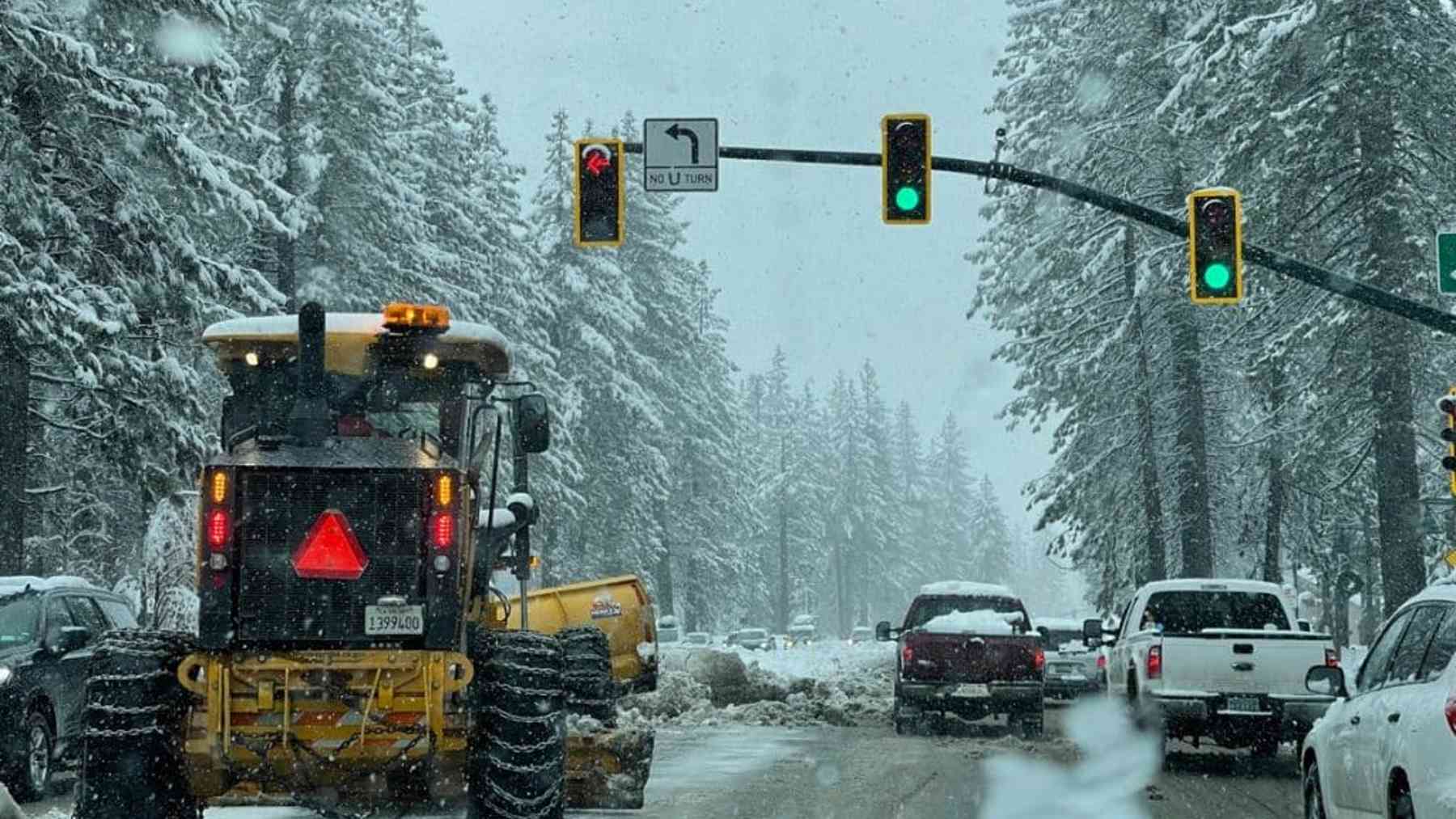
The ridgeline above Lake Tahoe disappeared into white on a Tuesday night in November.
Snowplows idled at trailheads, waiting.
Chain controls were in the forecast for Interstate 80 and Highway 50.
Forecasters had already drawn a box around the mountains and given it a name.
Inside that box, the snow was going to be measured in feet, not inches.
The question was never whether it would snow. It was how much, and how fast.
A river in the sky aimed itself at the mountains
The storm behind the warning was not an ordinary cold front. It rode in on what meteorologists call an atmospheric river, a long ribbon of water vapor drawn north from the Pacific, which forecasters identified as the moisture source feeding the low pressure system as it closed on the coast. According to NOAA, a strong atmospheric river can transport enormous amounts of water vapor, with the strongest events moving far more than the average flow of water at the mouth of the Mississippi River, all squeezed into a channel a few hundred miles wide.
That moisture travels low and fast, then runs straight into a wall of rock. When the air is forced up and over a range such as the Sierra Nevada along the California Nevada line, it cools and the vapor condenses into heavy precipitation that falls as rain or snow. The taller the slope, the harder the squeeze.
Elevation became destiny. Valley floors saw rain and slush, while a few thousand feet higher the same storm turned brutal, dumping snow by the foot instead of the inch.
The warning started at 5,000 feet and worsened from there
The National Weather Service issued a winter storm warning for portions of the Sierra above 5,000 feet from November 18 to 20, with the harshest numbers reserved for the highest terrain. It warned of difficult to impossible travel conditions, gusty winds, and snow accumulations of around 4 feet possible above 8,000 feet.
That is a snowbank taller than a standing man, built in roughly 48 hours, the span the warning covered from early Wednesday to early Friday. Closer to the lake, the Reno office put 2 to 4 feet above 7,000 feet and 1 to 2 feet around lake level.
Lower down, the numbers softened but stayed serious. Across the eastern Sierra counties near Susanville and Portola, forecasters expected 6 to 12 inches above 5,500 feet, with locally up to 2 feet west of US-395.
Lake Tahoe churned under punishing ridgetop winds
This storm reached all the way down to the water. For Truckee and the lakeside communities, the warning called for wind gusts of 30 to 40 mph, while exposed ridgetops above them could see gusts as high as 100 mph, strong enough to produce whiteout conditions along the crest.
Even the lake’s surface answered the wind. Forecasters raised their wave forecast as the storm closed in, with waves of 2 to 4 feet expected on Lake Tahoe, and small boats, kayaks and paddleboards were advised to stay off the water.
A lake known for still blue water was about to churn like open ocean. Travel through those towns, the warning said, could be “very difficult to impossible,” and the weather service suggested finishing necessary mountain driving before Tuesday evening.
A second storm arrived within the same week
None of this arrived alone. Forecasters had been tracking a parade of systems moving down the coast during the week of November 16, and this was the stronger of the pair, expected to reach California Tuesday night into Wednesday and raise the risk of flooding along central and southern parts of the coast.
The timing matters because it is still early in the season. The Sierra Nevada got its first real taste when one of the opening major snowfalls of the water year arrived on November 13, delivering heavy rain to lower elevations around Sacramento and snow accumulations of around a foot to some mountain areas. The November 18 warning piled a second, bigger dose on top of that head start, not unlike how a glacial basin near Juneau flooded twice within a single year once conditions lined up again.
There is a connection here to the sky above. The same imagery that tracks storm clouds from space is how forecasters follow an atmospheric river, a pale curling plume of water vapor crossing an entire ocean, much as satellite and radar data helped explain the strange groaning lake phenomenon at Yellowstone.
Travel stayed risky right up to the Friday expiration
None of the forecasts promised a clean finish. The Reno office updated the warning as the storm approached, raising the wave heights expected on Lake Tahoe and adding valley wind gusts, a reminder that mountain weather rarely behaves on a fixed schedule.
Even so, there was comfort in the pattern. Storms like this one are a normal part of how the Sierra Nevada builds its winter snowpack, the same snowpack that feeds reservoirs and rivers across California and Nevada for the rest of the year.
A rough week at Tahoe in November often means a fuller spring downstream. The plows kept moving, the chains stayed on, and the mountains wore their first real winter coat of the season, feet deep and still growing.
Read the whole thing?
Get the week's signal, not the noise
Our sharpest reporting on energy, climate and nature — free, once a week.