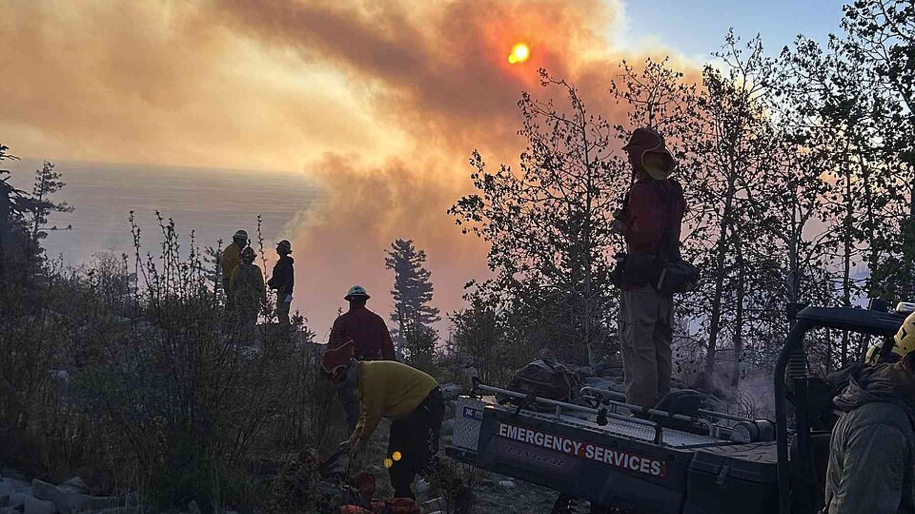
Smoke rolled off a Utah ridgeline on a July afternoon, climbing fast toward the towns below.
On the ground, crews watched the flame front hit a patch of pale, open forest floor and stutter.
That ground had burned once before, on purpose.
Nobody down there was certain the old scars would hold against a fire moving this fast.
What happened when the two fires met answers that question, and it starts with what the old ash actually did to the flames.
Old ash became a brake pedal for new flames
A wildfire needs fuel the way a car needs gas, and a prescribed burn removes exactly that. When fire crews had deliberately burned sections of Monroe Mountain in the years leading up to the blaze, they thinned out the dead branches, dried grass, and brush that a wildfire usually feeds on.
So when the new fire reached those same patches, it found a forest floor that had already been through a smaller, controlled version of the same event. That meant less fuel to burn and less heat produced per acre as flames crossed old ground.
Fire behavior analysts call this fuel discontinuity, a patchwork where intensity drops the moment a fire enters a zone that was already cleared. The effect does not stop a fire outright, but it buys something almost as valuable on a mountainside: time, and in wildfire response, time is often the only resource crews actually control.
More than 73,000 acres still outran the old burn scars
Even with that advantage, the numbers tell a blunter story. The Monroe Canyon Fire grew to 73,721 acres before crews closed the line around it, reaching full containment in early September. It was the largest Utah wildfire of its season, double the size of the next largest, the France Canyon Fire, which burned 34,943 acres.
So the old burn scars were never a wall. They were more like speed bumps scattered across a mountain highway, slowing certain stretches while the fire found open lanes elsewhere. Steep terrain, dry timber and persistent wind pushed flames uphill in long runs that outflanked treated ground in places.
Utah’s Department of Natural Resources reported that the fire’s intensity decreased near the edge of those treatment areas, the patchwork effect crews had hoped for. That contrast let firefighters see which parts of the earlier work were paying off, and where nothing was slowing the fire at all.
Fourteen straight days of red flag warnings tested every line
The fire burned through weather fire managers rarely see sustained so long. Accounts of the incident describe fourteen straight days of red flag fire weather, meaning low humidity, high heat and strong wind lined up together, while the prescribed burn areas still slowed and steered the fire away from communities. Officials also pointed to record breaking low fuel moistures as a contributor to the intense fire activity.
More than 900 personnel were assigned to the blaze when it covered roughly 10,000 acres at 9 percent containment, early in a run that would take it far higher. Firefighters reported wind gusts exceeding 60 miles per hour on the afternoon of July 25, when the fire began its rapid expansion.
Humidity that would normally dampen embers overnight instead stayed low, letting the fire keep moving after dark when it should have paused. That left the old burn scars doing double duty, slowing flames directly and giving firefighters safer ground to make a stand on.
Three towns got hours of breathing room, not days
The real payoff showed up closest to the places people actually lived. The fire burned in timber near the communities of Richfield, Monroe and Koosharem, and burnout operations helped slow its spread on July 27, giving evacuation planners room to work instead of reacting to flames already at the edge of town.
Structures were still lost. Two cabins burned in the fire’s first week as it threatened more homes on the mountain, and evacuations moved through Burrville, Monroe Canyon and parts of Poverty Canyon as conditions shifted.
Steep drainages and swinging winds kept reshaping the fire’s path for weeks, the same way terrain drives other hazards, including a mountainside collapse above a fjord near Juneau. What the old burns bought, in the end, was a fighting chance rather than a guarantee.
Ten years of burns leave a lesson for the next fire
Monroe Canyon left fire managers with a case study they can point to directly, rather than a model or a simulation. Over the past decade, the Forest Service has used prescribed burns and mechanical thinning in and around Monroe Canyon to promote aspen regeneration and reduce accumulated brush and dead vegetation. That work did not stop a 73,721 acre fire, but it changed where the fire slowed and where crews could safely stand.
Even so, nobody involved calls this a finished solution. Fire managers describe these aspen systems as self renewing but fire dependent, warning that without fire the stands will eventually die, which means the burning has to be repeated, much like the strain seen in wildfire response efforts playing out elsewhere this same season.
The honest takeaway from Monroe Mountain is modest but real. A decade of careful fire bought firefighters hours and sometimes days against a wildfire that nothing fully stopped, and on a mountain that size, that margin turned out to matter.
Read the whole thing?
Get the week's signal, not the noise
Our sharpest reporting on energy, climate and nature — free, once a week.